City Graph
251 Minnesota city nodes, 14 county nodes and 98 more of the 100 biggest US cities, each pinned at its GPS point. City and county GPS from the Census 2024 Gazetteer; neighborhoods from OpenStreetMap; Minnesota ZIP codes from the Minnesota city ZIP registry, US city ZIP codes from the Census.
Minnesota · Counties · United States
Minnesota


Afton, MN
Washington County · 44.898776, -92.819108
0 neighborhoods · 1 ZIP code


Aitkin, MN
Aitkin County · 46.52665, -93.704992
0 neighborhoods · 0 ZIP codes


Albany, MN
Stearns County · 45.626654, -94.563237
0 neighborhoods · 0 ZIP codes


Albert Lea, MN
Freeborn County · 43.654293, -93.364148
0 neighborhoods · 17 ZIP codes


Albertville, MN
Wright County · 45.236048, -93.662668
0 neighborhoods · 0 ZIP codes


Alexandria, MN
Douglas County · 45.877178, -95.376965
0 neighborhoods · 14 ZIP codes


Andover, MN
Anoka County · 45.25242, -93.337402
2 neighborhoods · 1 ZIP code


Annandale, MN
Wright County · 45.259597, -94.121049
0 neighborhoods · 6 ZIP codes


Anoka, MN
Anoka County · 45.214398, -93.391638
0 neighborhoods · 0 ZIP codes


Apple Valley, MN
Dakota County · 44.745301, -93.199413
5 neighborhoods · 1 ZIP code

Arden Hills, MN
Ramsey County · 45.071159, -93.165472
0 neighborhoods · 0 ZIP codes


Austin, MN
Mower County · 43.672098, -92.977863
0 neighborhoods · 13 ZIP codes


Avon, MN
Stearns County · 45.605505, -94.447741
0 neighborhoods · 0 ZIP codes


Baxter, MN
Crow Wing County · 46.343935, -94.276015
0 neighborhoods · 0 ZIP codes


Bayport, MN
Washington County · 45.014845, -92.778906
0 neighborhoods · 1 ZIP code
Baytown, MN
Washington County · 45.009025, -92.824726
0 neighborhoods · 0 ZIP codes


Becker, MN
Sherburne County · 45.386507, -93.887261
0 neighborhoods · 0 ZIP codes


Belle Plaine, MN
Scott County · 44.61978, -93.764595
0 neighborhoods · 1 ZIP code


Bemidji, MN
Beltrami County · 47.487034, -94.88269
0 neighborhoods · 34 ZIP codes


Benson, MN
Swift County · 45.315182, -95.60537
0 neighborhoods · 7 ZIP codes


Bethel, MN
Anoka County · 45.40442, -93.274901
0 neighborhoods · 0 ZIP codes

Big Lake, MN
Sherburne County · 45.342422, -93.743036
2 neighborhoods · 2 ZIP codes

Birchwood Village, MN
Washington County · 45.059981, -92.978025
0 neighborhoods · 0 ZIP codes


Bird Island, MN
Renville County · 44.765016, -94.894194
0 neighborhoods · 0 ZIP codes
Blaine, MN
Anoka County · 45.170515, -93.206089
4 neighborhoods · 2 ZIP codes

Bloomington, MN
Hennepin County · 44.829666, -93.315217
2 neighborhoods · 5 ZIP codes


Braham, MN
Isanti County · 45.722348, -93.172197
0 neighborhoods · 0 ZIP codes
Brainerd, MN
Crow Wing County · 46.355269, -94.198372
0 neighborhoods · 20 ZIP codes


Breckenridge, MN
Wilkin County · 46.265925, -96.584616
0 neighborhoods · 0 ZIP codes
Brooklyn Center, MN
Hennepin County · 45.06797, -93.317829
0 neighborhoods · 1 ZIP code
Brooklyn Park, MN
Hennepin County · 45.110906, -93.349088
0 neighborhoods · 3 ZIP codes

Buffalo, MN
Wright County · 45.17951, -93.863995
12 neighborhoods · 2 ZIP codes
Burnsville, MN
Dakota County · 44.764409, -93.279372
0 neighborhoods · 2 ZIP codes


Byron, MN
Olmsted County · 44.038107, -92.641072
0 neighborhoods · 1 ZIP code


Cambridge, MN
Isanti County · 45.560772, -93.227702
1 neighborhood · 5 ZIP codes


Cannon Falls, MN
Goodhue County · 44.517265, -92.889342
0 neighborhoods · 4 ZIP codes


Carver, MN
Carver County · 44.761475, -93.632544
0 neighborhoods · 0 ZIP codes
Centerville, MN
Anoka County · 45.167461, -93.055168
0 neighborhoods · 0 ZIP codes
Champlin, MN
Hennepin County · 45.172932, -93.386829
1 neighborhood · 1 ZIP code

Chanhassen, MN
Carver County · 44.854285, -93.562384
12 neighborhoods · 1 ZIP code

Chaska, MN
Carver County · 44.816364, -93.610023
3 neighborhoods · 3 ZIP codes


Chisago City, MN
Chisago County · 45.372274, -92.916665
0 neighborhoods · 0 ZIP codes
Circle Pines, MN
Anoka County · 45.143748, -93.147517
0 neighborhoods · 1 ZIP code


Clear Lake, MN
Sherburne County · 45.448615, -94.001429
0 neighborhoods · 0 ZIP codes
Clearwater, MN
Wright County · 45.409879, -94.04456
0 neighborhoods · 0 ZIP codes


Cloquet, MN
Carlton County · 46.72507, -92.50133
0 neighborhoods · 18 ZIP codes


Cokato, MN
Wright County · 45.076721, -94.187548
0 neighborhoods · 0 ZIP codes


Cold Spring, MN
Stearns County · 45.458256, -94.428154
0 neighborhoods · 0 ZIP codes

Cologne, MN
Carver County · 44.769825, -93.792428
0 neighborhoods · 0 ZIP codes
Columbia Heights, MN
Anoka County · 45.049104, -93.246749
0 neighborhoods · 1 ZIP code

Columbus, MN
Anoka County · 45.254914, -93.107678
0 neighborhoods · 0 ZIP codes
Coon Rapids, MN
Anoka County · 45.176411, -93.311454
18 neighborhoods · 2 ZIP codes

Corcoran, MN
Hennepin County · 45.106897, -93.577979
2 neighborhoods · 1 ZIP code


Cottage Grove, MN
Washington County · 44.813326, -92.914315
0 neighborhoods · 1 ZIP code


Crookston, MN
Polk County · 47.77474, -96.606426
0 neighborhoods · 19 ZIP codes


Crosslake, MN
Crow Wing County · 46.678212, -94.102014
0 neighborhoods · 0 ZIP codes
Crystal, MN
Hennepin County · 45.03731, -93.359478
8 neighborhoods · 1 ZIP code
Dayton, MN
Hennepin County · 45.189088, -93.471575
1 neighborhood · 1 ZIP code
Deephaven, MN
Hennepin County · 44.931974, -93.529104
0 neighborhoods · 0 ZIP codes


Delano, MN
Wright County · 45.038266, -93.793012
0 neighborhoods · 2 ZIP codes
Dellwood, MN
Washington County · 45.098812, -92.967619
0 neighborhoods · 0 ZIP codes


Detroit Lakes, MN
Becker County · 46.807582, -95.846612
0 neighborhoods · 14 ZIP codes


Duluth, MN
St. Louis County · 46.774458, -92.134135
0 neighborhoods · 8 ZIP codes
Eagan, MN
Dakota County · 44.815217, -93.162816
0 neighborhoods · 3 ZIP codes
East Bethel, MN
Anoka County · 45.353204, -93.21766
0 neighborhoods · 2 ZIP codes

East Gull Lake, MN
Cass County · 46.397047, -94.363791
0 neighborhoods · 0 ZIP codes
Eden Prairie, MN
Hennepin County · 44.849595, -93.458721
0 neighborhoods · 3 ZIP codes


Eden Valley, MN
Meeker County · 45.325566, -94.545926
0 neighborhoods · 0 ZIP codes
Edina, MN
Hennepin County · 44.891123, -93.359752
21 neighborhoods · 4 ZIP codes
Elk River, MN
Sherburne County · 45.332212, -93.566528
13 neighborhoods · 1 ZIP code


Elko New Market, MN
Scott County · 44.567066, -93.334315
0 neighborhoods · 0 ZIP codes


Emily, MN
Crow Wing County · 46.769011, -93.980502
0 neighborhoods · 0 ZIP codes


Eveleth, MN
St. Louis County · 47.474921, -92.54961
0 neighborhoods · 22 ZIP codes
Excelsior, MN
Hennepin County · 44.902695, -93.56643
0 neighborhoods · 0 ZIP codes


Fairmont, MN
Martin County · 43.644789, -94.464015
0 neighborhoods · 19 ZIP codes
Falcon Heights, MN
Ramsey County · 44.988052, -93.174659
3 neighborhoods · 1 ZIP code


Faribault, MN
Rice County · 44.299709, -93.278946
0 neighborhoods · 4 ZIP codes
Farmington, MN
Dakota County · 44.659163, -93.168705
1 neighborhood · 1 ZIP code


Fergus Falls, MN
Otter Tail County · 46.285017, -96.07611
0 neighborhoods · 15 ZIP codes


Foley, MN
Benton County · 45.663559, -93.909506
0 neighborhoods · 0 ZIP codes

Forest Lake, MN
Washington County · 45.250831, -92.96692
0 neighborhoods · 1 ZIP code
Fridley, MN
Anoka County · 45.084246, -93.26005
0 neighborhoods · 1 ZIP code
Gem Lake, MN
Ramsey County · 45.061068, -93.038067
0 neighborhoods · 0 ZIP codes


Glencoe, MN
McLeod County · 44.769566, -94.151027
0 neighborhoods · 6 ZIP codes
Golden Valley, MN
Hennepin County · 44.990233, -93.358736
2 neighborhoods · 2 ZIP codes


Grand Rapids, MN
Itasca County · 47.238518, -93.53257
0 neighborhoods · 27 ZIP codes


Granite Falls, MN
Chippewa County · 44.807268, -95.542338
0 neighborhoods · 9 ZIP codes

Grant, MN
Washington County · 45.082077, -92.910948
0 neighborhoods · 1 ZIP code
Greenfield, MN
Hennepin County · 45.094065, -93.690773
0 neighborhoods · 1 ZIP code
Greenwood, MN
Hennepin County · 44.912956, -93.553999
0 neighborhoods · 0 ZIP codes
Ham Lake, MN
Anoka County · 45.25393, -93.194841
0 neighborhoods · 0 ZIP codes
Hanover, MN
Wright County · 45.157755, -93.66275
0 neighborhoods · 2 ZIP codes


Hastings, MN
Dakota County · 44.73178, -92.854512
1 neighborhood · 2 ZIP codes

Hermantown, MN
St. Louis County · 46.802343, -92.240837
0 neighborhoods · 4 ZIP codes


Hibbing, MN
St. Louis County · 47.395902, -92.946466
0 neighborhoods · 13 ZIP codes
Hilltop, MN
Anoka County · 45.053579, -93.250127
0 neighborhoods · 0 ZIP codes
Hopkins, MN
Hennepin County · 44.925107, -93.404494
3 neighborhoods · 0 ZIP codes
Howard Lake, MN
Wright County · 45.053986, -94.061
0 neighborhoods · 0 ZIP codes
Hugo, MN
Washington County · 45.164225, -92.960105
0 neighborhoods · 1 ZIP code


Hutchinson, MN
McLeod County · 44.885358, -94.376876
0 neighborhoods · 9 ZIP codes
Independence, MN
Hennepin County · 45.018594, -93.71975
0 neighborhoods · 1 ZIP code
Inver Grove Heights, MN
Dakota County · 44.829015, -93.060072
0 neighborhoods · 2 ZIP codes

Isanti, MN
Isanti County · 45.491545, -93.242818
0 neighborhoods · 1 ZIP code
Jordan, MN
Scott County · 44.66463, -93.640222
0 neighborhoods · 0 ZIP codes

Kasson, MN
Dodge County · 44.033174, -92.748578
0 neighborhoods · 6 ZIP codes
Kimball, MN
Stearns County · 45.31433, -94.300807
0 neighborhoods · 0 ZIP codes
Lake Elmo, MN
Washington County · 44.987847, -92.909654
0 neighborhoods · 1 ZIP code
Lakeland, MN
Washington County · 44.953174, -92.76663
0 neighborhoods · 1 ZIP code
Lakeville, MN
Dakota County · 44.676134, -93.251743
2 neighborhoods · 2 ZIP codes
Landfall, MN
Washington County · 44.950029, -92.976955
0 neighborhoods · 0 ZIP codes
Lauderdale, MN
Ramsey County · 44.994407, -93.203134
0 neighborhoods · 0 ZIP codes


Le Sueur, MN
Le Sueur County · 44.470513, -93.901773
0 neighborhoods · 2 ZIP codes
Lexington, MN
Anoka County · 45.138153, -93.171375
0 neighborhoods · 0 ZIP codes
Lilydale, MN
Dakota County · 44.908785, -93.130754
0 neighborhoods · 0 ZIP codes
Lindstrom, MN
Chisago County · 45.385816, -92.843674
0 neighborhoods · 6 ZIP codes
Lino Lakes, MN
Anoka County · 45.15546, -93.106858
0 neighborhoods · 0 ZIP codes


Litchfield, MN
Meeker County · 45.12197, -94.525901
0 neighborhoods · 0 ZIP codes
Little Canada, MN
Ramsey County · 45.023265, -93.083655
0 neighborhoods · 0 ZIP codes


Little Falls, MN
Morrison County · 45.985557, -94.359676
0 neighborhoods · 0 ZIP codes
Long Lake, MN
Hennepin County · 44.983248, -93.570054
0 neighborhoods · 0 ZIP codes


Long Prairie, MN
Todd County · 45.97472, -94.861352
0 neighborhoods · 8 ZIP codes


Lonsdale, MN
Rice County · 44.477631, -93.424226
0 neighborhoods · 0 ZIP codes
Loretto, MN
Hennepin County · 45.054769, -93.635337
0 neighborhoods · 0 ZIP codes
Mahtomedi, MN
Washington County · 45.058292, -92.970186
0 neighborhoods · 0 ZIP codes


Mankato, MN
Blue Earth County · 44.171122, -93.97638
0 neighborhoods · 10 ZIP codes
Maple Grove, MN
Hennepin County · 45.112764, -93.462975
34 neighborhoods · 2 ZIP codes
Maple Lake, MN
Wright County · 45.232626, -94.009546
0 neighborhoods · 0 ZIP codes
Maple Plain, MN
Hennepin County · 45.008633, -93.662369
0 neighborhoods · 0 ZIP codes
Maplewood, MN
Ramsey County · 45.019015, -93.03106
6 neighborhoods · 2 ZIP codes

Marine on St. Croix, MN
Washington County · 45.190929, -92.77843
0 neighborhoods · 1 ZIP code


Marshall, MN
Lyon County · 44.449061, -95.789201
0 neighborhoods · 30 ZIP codes
Medicine Lake, MN
Hennepin County · 44.995786, -93.418072
0 neighborhoods · 0 ZIP codes
Medina, MN
Hennepin County · 45.03452, -93.575598
13 neighborhoods · 0 ZIP codes


Melrose, MN
Stearns County · 45.677008, -94.814774
0 neighborhoods · 14 ZIP codes
Mendota, MN
Dakota County · 44.887493, -93.161716
0 neighborhoods · 2 ZIP codes
Mendota Heights, MN
Dakota County · 44.878932, -93.133929
0 neighborhoods · 1 ZIP code
Minneapolis, MN
Hennepin County · 44.963324, -93.26832
96 neighborhoods · 20 ZIP codes
Minnetonka, MN
Hennepin County · 44.93256, -93.456705
0 neighborhoods · 3 ZIP codes
Minnetonka Beach, MN
Hennepin County · 44.939625, -93.587127
0 neighborhoods · 0 ZIP codes
Minnetrista, MN
Hennepin County · 44.938619, -93.712387
0 neighborhoods · 1 ZIP code


Montevideo, MN
Chippewa County · 44.950165, -95.715382
0 neighborhoods · 9 ZIP codes
Montgomery, MN
Le Sueur County · 44.445075, -93.579753
0 neighborhoods · 7 ZIP codes
Monticello, MN
Wright County · 45.294103, -93.786294
4 neighborhoods · 1 ZIP code
Montrose, MN
Wright County · 45.066545, -93.920253
0 neighborhoods · 4 ZIP codes


Moorhead, MN
Clay County · 46.864704, -96.744552
0 neighborhoods · 16 ZIP codes


Mora, MN
Kanabec County · 45.876981, -93.290284
0 neighborhoods · 8 ZIP codes


Morris, MN
Stevens County · 45.585879, -95.905406
0 neighborhoods · 20 ZIP codes


Motley, MN
Morrison County · 46.334754, -94.642772
0 neighborhoods · 0 ZIP codes
Mound, MN
Hennepin County · 44.93196, -93.658302
0 neighborhoods · 2 ZIP codes
Mounds View, MN
Ramsey County · 45.106737, -93.206834
0 neighborhoods · 0 ZIP codes
New Brighton, MN
Ramsey County · 45.067226, -93.205779
0 neighborhoods · 1 ZIP code
New Hope, MN
Hennepin County · 45.035943, -93.386886
0 neighborhoods · 1 ZIP code
New Prague, MN
Scott County · 44.545738, -93.575595
0 neighborhoods · 0 ZIP codes


New Ulm, MN
Brown County · 44.312067, -94.468896
0 neighborhoods · 7 ZIP codes
Newport, MN
Washington County · 44.874399, -92.998647
0 neighborhoods · 2 ZIP codes


Nisswa, MN
Crow Wing County · 46.500661, -94.297783
0 neighborhoods · 0 ZIP codes

North Branch, MN
Chisago County · 45.509885, -92.955655
1 neighborhood · 0 ZIP codes


North Mankato, MN
Nicollet County · 44.182714, -94.041128
0 neighborhoods · 6 ZIP codes
North Oaks, MN
Ramsey County · 45.10484, -93.101065
0 neighborhoods · 0 ZIP codes
North St. Paul, MN
Ramsey County · 45.013522, -93.00184
0 neighborhoods · 0 ZIP codes

Northfield, MN
Rice County · 44.455645, -93.170311
3 neighborhoods · 4 ZIP codes
Norwood Young America, MN
Carver County · 44.772107, -93.917287
0 neighborhoods · 5 ZIP codes
Nowthen, MN
Anoka County · 45.343116, -93.449553
0 neighborhoods · 0 ZIP codes
Oak Grove, MN
Anoka County · 45.348351, -93.32727
0 neighborhoods · 0 ZIP codes
Oak Park Heights, MN
Washington County · 45.033432, -92.810186
0 neighborhoods · 0 ZIP codes
Oakdale, MN
Washington County · 44.987546, -92.963553
0 neighborhoods · 1 ZIP code
Orono, MN
Hennepin County · 44.96098, -93.587728
1 neighborhood · 2 ZIP codes
Osseo, MN
Hennepin County · 45.117866, -93.3992
0 neighborhoods · 0 ZIP codes
Otsego, MN
Wright County · 45.264286, -93.620742
7 neighborhoods · 1 ZIP code


Owatonna, MN
Steele County · 44.091904, -93.231715
0 neighborhoods · 5 ZIP codes

Paynesville, MN
Stearns County · 45.378519, -94.721592
0 neighborhoods · 0 ZIP codes


Pelican Rapids, MN
Otter Tail County · 46.570281, -96.085853
0 neighborhoods · 0 ZIP codes


Pequot Lakes, MN
Crow Wing County · 46.588091, -94.287969
0 neighborhoods · 0 ZIP codes


Perham, MN
Otter Tail County · 46.599611, -95.577104
0 neighborhoods · 13 ZIP codes


Pine City, MN
Pine County · 45.84098, -92.966492
0 neighborhoods · 10 ZIP codes


Pine Island, MN
Goodhue County · 44.198124, -92.628119
0 neighborhoods · 6 ZIP codes


Pine River, MN
Cass County · 46.723289, -94.396599
0 neighborhoods · 0 ZIP codes
Pine Springs, MN
Washington County · 45.038031, -92.95594
0 neighborhoods · 0 ZIP codes


Plainview, MN
Wabasha County · 44.164687, -92.16919
0 neighborhoods · 8 ZIP codes
Plymouth, MN
Hennepin County · 45.022312, -93.462883
52 neighborhoods · 4 ZIP codes


Princeton, MN
Mille Lacs County · 45.568215, -93.590254
0 neighborhoods · 0 ZIP codes
Prior Lake, MN
Scott County · 44.725594, -93.440877
6 neighborhoods · 1 ZIP code
Ramsey, MN
Anoka County · 45.260019, -93.452233
0 neighborhoods · 1 ZIP code


Red Wing, MN
Goodhue County · 44.581265, -92.605011
0 neighborhoods · 5 ZIP codes


Redwood Falls, MN
Redwood County · 44.547125, -95.102637
0 neighborhoods · 0 ZIP codes


Rice, MN
Benton County · 45.758617, -94.242906
0 neighborhoods · 0 ZIP codes
Richfield, MN
Hennepin County · 44.874354, -93.282445
0 neighborhoods · 1 ZIP code

Richmond, MN
Stearns County · 45.454513, -94.513607
0 neighborhoods · 0 ZIP codes
Robbinsdale, MN
Hennepin County · 45.024534, -93.330644
0 neighborhoods · 0 ZIP codes

Rochester, MN
Olmsted County · 44.014299, -92.478592
0 neighborhoods · 14 ZIP codes
Rockford, MN
Wright County · 45.090841, -93.745218
2 neighborhoods · 1 ZIP code
Rogers, MN
Hennepin County · 45.18385, -93.571669
39 neighborhoods · 1 ZIP code
Rosemount, MN
Dakota County · 44.745814, -93.068864
5 neighborhoods · 1 ZIP code
Roseville, MN
Ramsey County · 45.015625, -93.153807
0 neighborhoods · 1 ZIP code


Royalton, MN
Morrison County · 45.830329, -94.292615
0 neighborhoods · 0 ZIP codes

Rush City, MN
Chisago County · 45.687442, -92.965303
0 neighborhoods · 0 ZIP codes

Sartell, MN
Stearns County · 45.61809, -94.212153
0 neighborhoods · 10 ZIP codes
Sauk Centre, MN
Stearns County · 45.736472, -94.952729
0 neighborhoods · 0 ZIP codes
Sauk Rapids, MN
Benton County · 45.594724, -94.152747
0 neighborhoods · 0 ZIP codes
Savage, MN
Scott County · 44.759057, -93.364213
1 neighborhood · 1 ZIP code
Scandia, MN
Washington County · 45.251536, -92.833409
0 neighborhoods · 1 ZIP code
Shakopee, MN
Scott County · 44.771906, -93.475699
3 neighborhoods · 1 ZIP code
Shoreview, MN
Ramsey County · 45.082989, -93.140492
0 neighborhoods · 1 ZIP code
Shorewood, MN
Hennepin County · 44.902442, -93.595334
0 neighborhoods · 1 ZIP code

Sleepy Eye, MN
Brown County · 44.298945, -94.723594
0 neighborhoods · 19 ZIP codes
South Haven, MN
Wright County · 45.292736, -94.217376
0 neighborhoods · 0 ZIP codes
South St. Paul, MN
Dakota County · 44.888027, -93.040497
0 neighborhoods · 1 ZIP code
Spring Lake Park, MN
Anoka County · 45.11593, -93.245164
0 neighborhoods · 0 ZIP codes
Spring Park, MN
Hennepin County · 44.935926, -93.63011
0 neighborhoods · 0 ZIP codes
St. Anthony, MN
Hennepin County · 45.688967, -94.61165
0 neighborhoods · 0 ZIP codes
St. Augusta, MN
Stearns County · 45.450173, -94.193785
0 neighborhoods · 5 ZIP codes
St. Bonifacius, MN
Hennepin County · 44.905066, -93.748288
0 neighborhoods · 0 ZIP codes
St. Cloud, MN
Stearns County · 45.526658, -94.171007
0 neighborhoods · 6 ZIP codes
St. Francis, MN
Anoka County · 45.394034, -93.394117
0 neighborhoods · 1 ZIP code


St. James, MN
Watonwan County · 43.983362, -94.625392
0 neighborhoods · 0 ZIP codes
St. Joseph, MN
Stearns County · 45.56507, -94.30207
0 neighborhoods · 0 ZIP codes
St. Louis Park, MN
Hennepin County · 44.948681, -93.365035
0 neighborhoods · 2 ZIP codes
St. Marys Point, MN
Washington County · 44.910548, -92.770157
0 neighborhoods · 0 ZIP codes
St. Michael, MN
Wright County · 45.199238, -93.689526
0 neighborhoods · 0 ZIP codes
St. Paul, MN
Ramsey County · 44.948901, -93.104063
38 neighborhoods · 10 ZIP codes
St. Paul Park, MN
Washington County · 44.83568, -92.994128
0 neighborhoods · 0 ZIP codes


St. Peter, MN
Nicollet County · 44.329282, -93.967656
0 neighborhoods · 5 ZIP codes
Stacy, MN
Chisago County · 45.423044, -92.97032
0 neighborhoods · 0 ZIP codes

Staples, MN
Wadena County · 46.372154, -94.815011
0 neighborhoods · 9 ZIP codes
Stillwater, MN
Washington County · 45.058606, -92.830408
13 neighborhoods · 1 ZIP code
Sunfish Lake, MN
Dakota County · 44.872673, -93.086963
0 neighborhoods · 0 ZIP codes


Thief River Falls, MN
Pennington County · 48.111241, -96.177562
0 neighborhoods · 40 ZIP codes
Tonka Bay, MN
Hennepin County · 44.914403, -93.585542
0 neighborhoods · 0 ZIP codes


Two Harbors, MN
Lake County · 47.029954, -91.675744
0 neighborhoods · 13 ZIP codes
Vadnais Heights, MN
Ramsey County · 45.057938, -93.066454
0 neighborhoods · 1 ZIP code
Victoria, MN
Carver County · 44.862117, -93.658426
6 neighborhoods · 1 ZIP code

Waconia, MN
Carver County · 44.84153, -93.790092
0 neighborhoods · 3 ZIP codes


Wadena, MN
Wadena County · 46.447194, -95.126697
0 neighborhoods · 0 ZIP codes
Waite Park, MN
Stearns County · 45.520868, -94.242982
0 neighborhoods · 0 ZIP codes


Walker, MN
Cass County · 47.090803, -94.586932
0 neighborhoods · 0 ZIP codes
Watertown, MN
Carver County · 44.960214, -93.843921
1 neighborhood · 0 ZIP codes
Waverly, MN
Wright County · 45.06374, -93.966628
0 neighborhoods · 0 ZIP codes
Wayzata, MN
Hennepin County · 44.969981, -93.518214
0 neighborhoods · 0 ZIP codes
West Lakeland, MN
Washington County · 44.976947, -92.815108
0 neighborhoods · 0 ZIP codes
West St. Paul, MN
Dakota County · 44.902414, -93.085327
0 neighborhoods · 1 ZIP code
White Bear Lake, MN
Ramsey County · 45.065214, -93.012871
0 neighborhoods · 1 ZIP code
White Bear Township, MN
Ramsey County · 45.101345, -93.024779
0 neighborhoods · 0 ZIP codes
Willernie, MN
Washington County · 45.053731, -92.957987
0 neighborhoods · 1 ZIP code


Willmar, MN
Kandiyohi County · 45.121029, -95.058734
0 neighborhoods · 17 ZIP codes


Windom, MN
Cottonwood County · 43.873552, -95.119136
0 neighborhoods · 0 ZIP codes


Winona, MN
Winona County · 44.051271, -91.668076
0 neighborhoods · 20 ZIP codes
Woodbury, MN
Washington County · 44.906283, -92.923703
0 neighborhoods · 2 ZIP codes
Woodland, MN
Hennepin County · 44.94976, -93.521372
0 neighborhoods · 0 ZIP codes


Worthington, MN
Nobles County · 43.628733, -95.599702
0 neighborhoods · 33 ZIP codes
Wyoming, MN
Chisago County · 45.339912, -92.968392
0 neighborhoods · 2 ZIP codes
Zimmerman, MN
Sherburne County · 45.440562, -93.596092
0 neighborhoods · 3 ZIP codes
Counties
Anoka County, MN
45.27411, -93.242723
20 cities in the graph
Benton County, MN
45.701225, -94.00144
3 cities in the graph

Carver County, MN
44.82132, -93.800091
8 cities in the graph
Chisago County, MN
45.505444, -92.903849
6 cities in the graph

Dakota County, MN
44.670893, -93.062481
14 cities in the graph
Hennepin County, MN
45.006121, -93.475228
42 cities in the graph
Isanti County, MN
45.562431, -93.296339
3 cities in the graph
Mille Lacs County, MN
45.929266, -93.632748
1 city in the graph
Ramsey County, MN
45.015204, -93.099965
16 cities in the graph
Scott County, MN
44.651811, -93.533733
7 cities in the graph
Sherburne County, MN
45.453166, -93.769164
5 cities in the graph
Stearns County, MN
45.555235, -94.610482
13 cities in the graph
Washington County, MN
45.037929, -92.890117
25 cities in the graph
Wright County, MN
45.175091, -93.966396
16 cities in the graph
United States
The 100 biggest US cities by 2024 Census population (Minneapolis and St. Paul are under Minnesota).


New York, NY
New York · 40.662712, -73.938677
307 neighborhoods · 211 ZIP codes


Los Angeles, CA
California · 34.019394, -118.410825
200 neighborhoods · 112 ZIP codes


Chicago, IL
Illinois · 41.837045, -87.684939
277 neighborhoods · 59 ZIP codes


Houston, TX
Texas · 29.785743, -95.388806
220 neighborhoods · 90 ZIP codes
Phoenix, AZ
Arizona · 33.572154, -112.090132
164 neighborhoods · 48 ZIP codes


Philadelphia, PA
Pennsylvania · 40.009376, -75.133346
171 neighborhoods · 49 ZIP codes


San Antonio, TX
Texas · 29.462809, -98.524635
31 neighborhoods · 50 ZIP codes


San Diego, CA
California · 32.814977, -117.135562
384 neighborhoods · 43 ZIP codes


Dallas, TX
Texas · 32.793333, -96.766513
30 neighborhoods · 48 ZIP codes


Jacksonville, FL
Florida · 30.336864, -81.661603
37 neighborhoods · 34 ZIP codes


Fort Worth, TX
Texas · 32.781954, -97.348573
2 neighborhoods · 34 ZIP codes

San Jose, CA
California · 37.296011, -121.814552
34 neighborhoods · 29 ZIP codes


Austin, TX
Texas · 30.298622, -97.754134
211 neighborhoods · 37 ZIP codes


Charlotte, NC
North Carolina · 35.209045, -80.83099
124 neighborhoods · 28 ZIP codes


Columbus, OH
Ohio · 39.983938, -82.984882
147 neighborhoods · 33 ZIP codes


Indianapolis, IN
Indiana · 39.776664, -86.145935
84 neighborhoods · 36 ZIP codes


San Francisco, CA
California · 37.727239, -123.032229
76 neighborhoods · 28 ZIP codes


Seattle, WA
Washington · 47.619335, -122.351538
125 neighborhoods · 29 ZIP codes
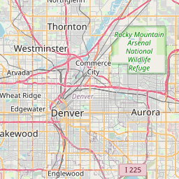
Denver, CO
Colorado · 39.76185, -104.881105
96 neighborhoods · 32 ZIP codes


Oklahoma City, OK
Oklahoma · 35.467079, -97.513657
15 neighborhoods · 50 ZIP codes


Nashville, TN
Tennessee · 36.1718, -86.785002
19 neighborhoods · 30 ZIP codes
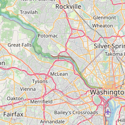

Washington, DC
District of Columbia · 38.904247, -77.016517
116 neighborhoods · 57 ZIP codes


El Paso, TX
Texas · 31.84778, -106.431106
59 neighborhoods · 19 ZIP codes


Las Vegas, NV
Nevada · 36.233499, -115.264037
66 neighborhoods · 19 ZIP codes
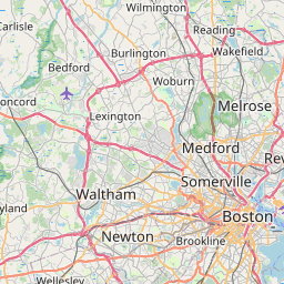

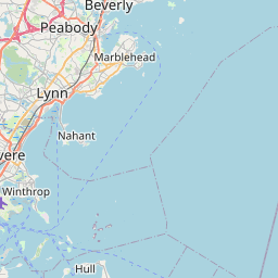

Boston, MA
Massachusetts · 42.338551, -71.018253
72 neighborhoods · 32 ZIP codes


Detroit, MI
Michigan · 42.383037, -83.102237
159 neighborhoods · 29 ZIP codes


Louisville, KY
Kentucky · 38.165376, -85.647377
0 neighborhoods · 20 ZIP codes


Portland, OR
Oregon · 45.536951, -122.649971
131 neighborhoods · 28 ZIP codes


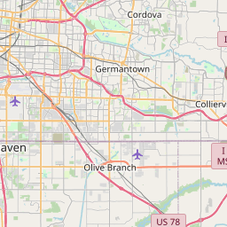
Memphis, TN
Tennessee · 35.109164, -89.968511
27 neighborhoods · 29 ZIP codes


Baltimore, MD
Maryland · 39.300032, -76.610476
263 neighborhoods · 26 ZIP codes


Milwaukee, WI
Wisconsin · 43.063348, -87.966695
209 neighborhoods · 24 ZIP codes
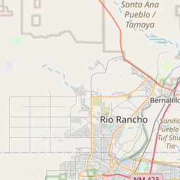
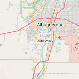
Albuquerque, NM
New Mexico · 35.10478, -106.646809
31 neighborhoods · 14 ZIP codes


Tucson, AZ
Arizona · 32.153036, -110.870773
49 neighborhoods · 24 ZIP codes


Fresno, CA
California · 36.782684, -119.793359
3 neighborhoods · 17 ZIP codes
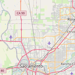
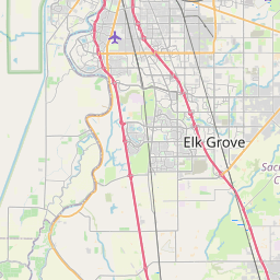
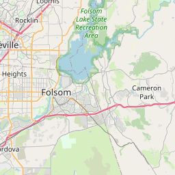
Sacramento, CA
California · 38.567694, -121.468161
78 neighborhoods · 19 ZIP codes


Atlanta, GA
Georgia · 33.762909, -84.422675
92 neighborhoods · 25 ZIP codes
Mesa, AZ
Arizona · 33.400626, -111.716487
34 neighborhoods · 12 ZIP codes


Kansas City, MO
Missouri · 39.125155, -94.550313
92 neighborhoods · 48 ZIP codes
Raleigh, NC
North Carolina · 35.831868, -78.641042
24 neighborhoods · 16 ZIP codes


Colorado Springs, CO
Colorado · 38.867255, -104.760749
20 neighborhoods · 22 ZIP codes


Omaha, NE
Nebraska · 41.262705, -96.053475
16 neighborhoods · 28 ZIP codes


Miami, FL
Florida · 25.775163, -80.208615
10 neighborhoods · 19 ZIP codes


Virginia Beach, VA
Virginia · 36.779525, -76.029142
137 neighborhoods · 12 ZIP codes


Long Beach, CA
California · 33.780791, -118.16818
9 neighborhoods · 14 ZIP codes
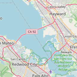
Oakland, CA
California · 37.769846, -122.22569
56 neighborhoods · 16 ZIP codes


Bakersfield, CA
California · 35.353171, -119.037919
0 neighborhoods · 6 ZIP codes


Tulsa, OK
Oklahoma · 36.127949, -95.902316
324 neighborhoods · 27 ZIP codes
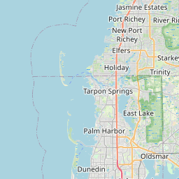
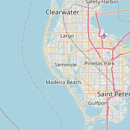
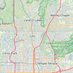
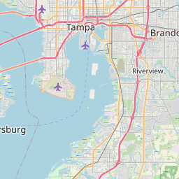
Tampa, FL
Florida · 27.970086, -82.479673
235 neighborhoods · 17 ZIP codes
Arlington, TX
Texas · 32.700708, -97.124691
8 neighborhoods · 13 ZIP codes
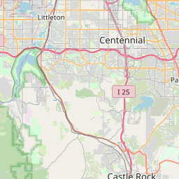

Aurora, CO
Colorado · 39.709537, -104.720509
17 neighborhoods · 10 ZIP codes


Wichita, KS
Kansas · 37.690638, -97.345836
4 neighborhoods · 22 ZIP codes


Cleveland, OH
Ohio · 41.478462, -81.679435
99 neighborhoods · 19 ZIP codes

New Orleans, LA
Louisiana · 30.05342, -89.934502
42 neighborhoods · 20 ZIP codes


Henderson, NV
Nevada · 36.008958, -115.0268
36 neighborhoods · 9 ZIP codes


Urban Honolulu, HI
Hawaii · 21.324347, -157.84764
0 neighborhoods · 14 ZIP codes

Anaheim, CA
California · 33.855502, -117.758657
5 neighborhoods · 7 ZIP codes


Orlando, FL
Florida · 28.40865, -81.254805
37 neighborhoods · 16 ZIP codes


Lexington, KY
Kentucky · 38.040678, -84.458272
59 neighborhoods · 16 ZIP codes


Stockton, CA
California · 37.976553, -121.308598
2 neighborhoods · 8 ZIP codes


Riverside, CA
California · 33.938143, -117.393168
31 neighborhoods · 8 ZIP codes

Irvine, CA
California · 33.678399, -117.771254
56 neighborhoods · 10 ZIP codes


Corpus Christi, TX
Texas · 27.754252, -97.173385
14 neighborhoods · 18 ZIP codes


Newark, NJ
New Jersey · 40.72422, -74.172574
3 neighborhoods · 9 ZIP codes
Santa Ana, CA
California · 33.736332, -117.8829
23 neighborhoods · 6 ZIP codes


Cincinnati, OH
Ohio · 39.140183, -84.505829
71 neighborhoods · 26 ZIP codes
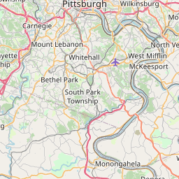
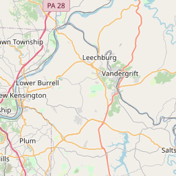
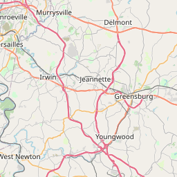
Pittsburgh, PA
Pennsylvania · 40.439936, -79.975676
115 neighborhoods · 23 ZIP codes
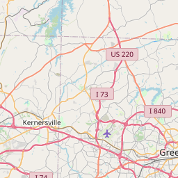
Greensboro, NC
North Carolina · 36.09485, -79.823624
61 neighborhoods · 10 ZIP codes
Jersey City, NJ
New Jersey · 40.711417, -74.06476
8 neighborhoods · 7 ZIP codes
Durham, NC
North Carolina · 35.977928, -78.898109
78 neighborhoods · 8 ZIP codes
Lincoln, NE
Nebraska · 40.810284, -96.674856
460 neighborhoods · 15 ZIP codes


North Las Vegas, NV
Nevada · 36.289865, -115.089181
7 neighborhoods · 8 ZIP codes
Plano, TX
Texas · 33.050769, -96.747944
0 neighborhoods · 6 ZIP codes
Anchorage, AK
Alaska · 61.17425, -149.284329
2 neighborhoods · 17 ZIP codes
Gilbert, AZ
Arizona · 33.310345, -111.743121
6 neighborhoods · 7 ZIP codes

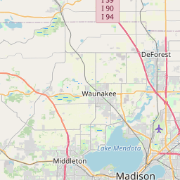

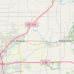

Madison, WI
Wisconsin · 43.087815, -89.429856
93 neighborhoods · 14 ZIP codes


Reno, NV
Nevada · 39.549097, -119.849907
15 neighborhoods · 10 ZIP codes
Chandler, AZ
Arizona · 33.282765, -111.851819
17 neighborhoods · 5 ZIP codes
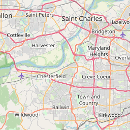
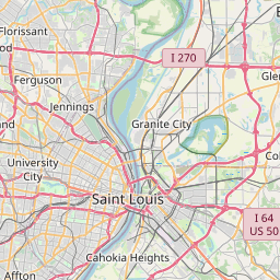
St. Louis, MO
Missouri · 38.635699, -90.244582
75 neighborhoods · 20 ZIP codes


Chula Vista, CA
California · 32.62767, -117.01517
39 neighborhoods · 5 ZIP codes
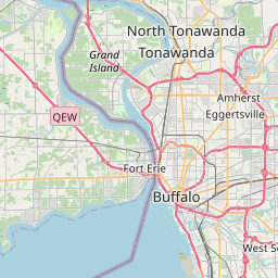
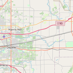
Buffalo, NY
New York · 42.892492, -78.859686
19 neighborhoods · 17 ZIP codes


Fort Wayne, IN
Indiana · 41.088193, -85.142791
4 neighborhoods · 11 ZIP codes


Lubbock, TX
Texas · 33.561901, -101.888883
9 neighborhoods · 11 ZIP codes
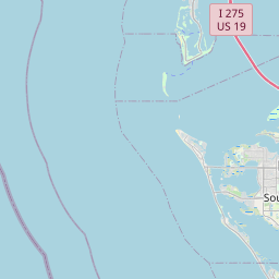
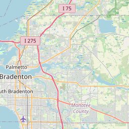
St. Petersburg, FL
Florida · 27.762727, -82.644131
57 neighborhoods · 11 ZIP codes


Toledo, OH
Ohio · 41.664071, -83.581861
53 neighborhoods · 14 ZIP codes


Laredo, TX
Texas · 27.560379, -99.489181
35 neighborhoods · 2 ZIP codes


Port St. Lucie, FL
Florida · 27.280554, -80.388261
0 neighborhoods · 6 ZIP codes
Glendale, AZ
Arizona · 33.533111, -112.189901
27 neighborhoods · 9 ZIP codes
Irving, TX
Texas · 32.857748, -96.970022
2 neighborhoods · 6 ZIP codes


Winston-Salem, NC
North Carolina · 36.102863, -80.260829
75 neighborhoods · 9 ZIP codes

Chesapeake, VA
Virginia · 36.679376, -76.301788
121 neighborhoods · 6 ZIP codes
Garland, TX
Texas · 32.909826, -96.630334
1 neighborhood · 5 ZIP codes


Scottsdale, AZ
Arizona · 33.684272, -111.861448
64 neighborhoods · 9 ZIP codes

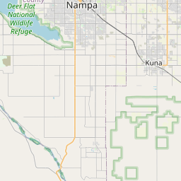

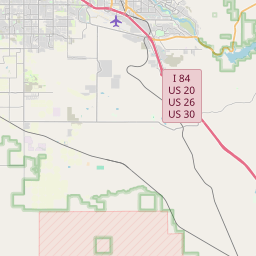

Boise, ID
Idaho · 43.599335, -116.229817
11 neighborhoods · 9 ZIP codes


Hialeah, FL
Florida · 25.869941, -80.302865
2 neighborhoods · 5 ZIP codes


Frisco, TX
Texas · 33.155427, -96.822596
2 neighborhoods · 4 ZIP codes


Richmond, VA
Virginia · 37.531399, -77.476009
112 neighborhoods · 14 ZIP codes
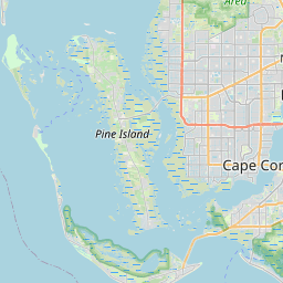
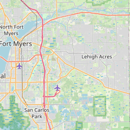
Cape Coral, FL
Florida · 26.643192, -81.997364
1 neighborhood · 6 ZIP codes


Norfolk, VA
Virginia · 36.923015, -76.244641
106 neighborhoods · 14 ZIP codes